
2026
RasterScope
Satellite land-cover change
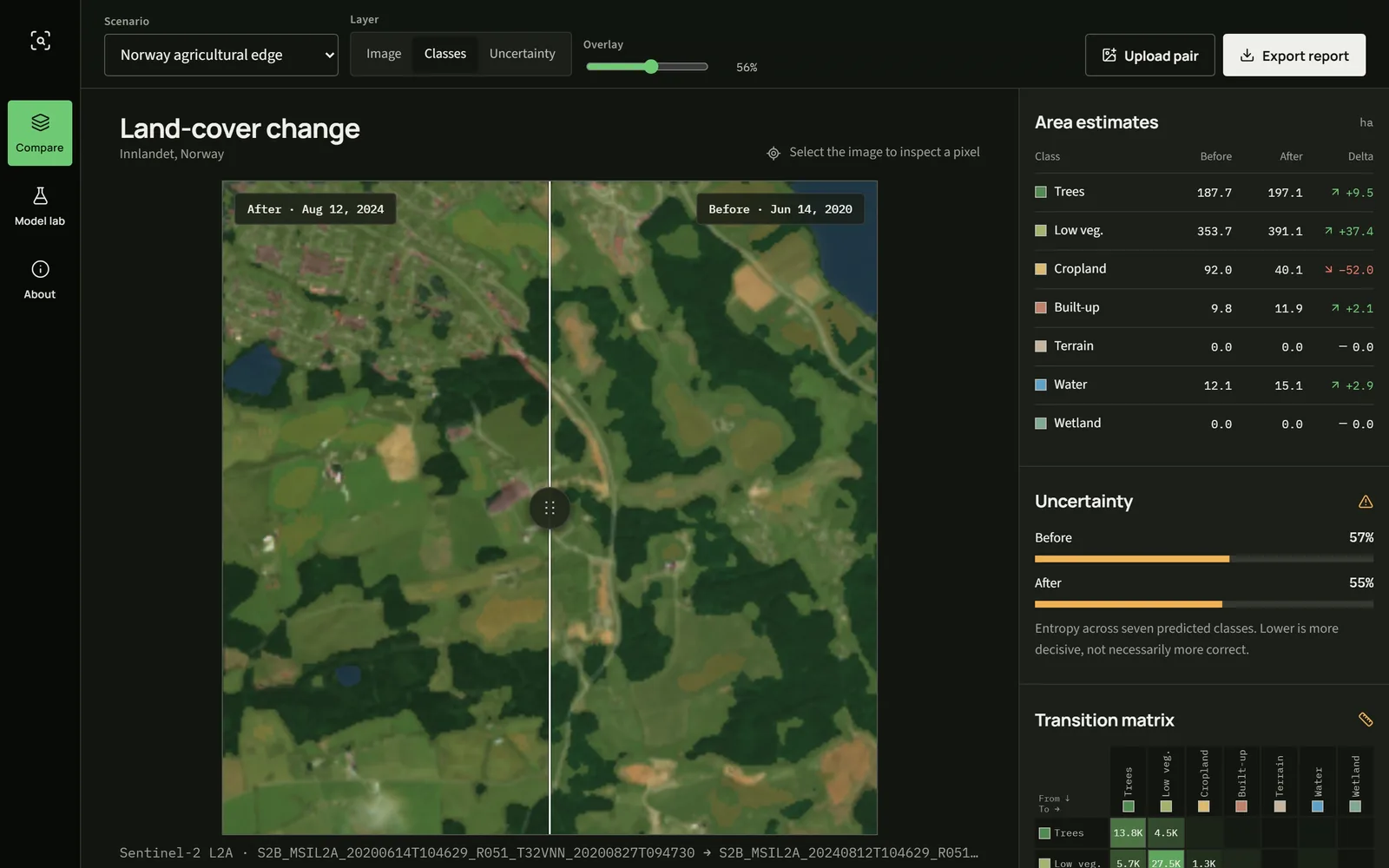
Local segmentation workbench with U-Net and ONNX Runtime, with uncertainty maps, pixel inspection, model benchmarking, transition matrices and offline reports.
Point RasterScope at two aligned satellite images of the same place, years apart. A compact U-Net labels every pixel with one of seven land-cover classes, and deterministic code turns those labels into hectares, deltas and a complete transition matrix.
The idea is that exactly one step in the system is uncertain, the neural network, and the interface says which one. Everything else is arithmetic you can read, test and re-run. It runs locally on CPU with ONNX Runtime, with no GPU, API key or cloud.
Side-by-side comparison
A draggable divider between the two dates, and a click on any pixel shows its class, confidence and entropy.
Honest about the model
The model lab shows mIoU, Dice, calibration and the confusion matrix, including the classes the network never predicts.
Auditable maths
Area per class is pixel count × 10 m × 10 m; transitions are a 7 × 7 count over the two masks. Those tests run in milliseconds, with no model.
Portable report
Exports the analysis as one self-contained HTML file, rendered from the same data shown on screen.